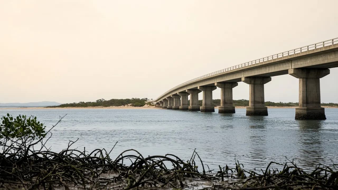
Bribie is close enough to Brisbane for a day trip and far enough that a sloppy transfer will eat the afternoon. The useful fact, repeated by Queensland Parks, is simple: the island is about 65 kilometres north of Brisbane, about 70 kilometres south of Caloundra, and linked to the mainland by a road bridge. No ferry is required for the townships.
This page is the arrival brief. It does not invent drive times to the minute, ticket prices, or a bus that “always connects”. Translink changes. Traffic changes. Check the planner.
Direct answer
From Brisbane, the standard drive is north on the Bruce Highway, take the Caboolture / Bribie Island exit pattern onto Bribie Island Road, and continue across the bridge at Sandstone Point into Bongaree. Without a car, ride the Caboolture line to Caboolture station and connect to a Translink bus — commonly route 640 — which crosses the bridge and serves Bongaree, the island park ’n’ ride, and often Woorim. Use the Translink journey planner for today’s times and fares.
Driving from Brisbane
The Bruce Highway is the spine. You are not hunting for a hidden island road; you are leaving a motorway for a suburban-then-coastal road that ends on a bridge. Sandstone Point is the mainland settlement on the approach. Once you cross, you are in Bongaree.
QPWS says the island can be reached via a road bridge from the Caboolture turn-off on the Bruce Highway. That is the official geographic sentence. Allow extra time on Friday afternoons, school holidays and wet weather. This guide will not publish a “usually 55 minutes” claim as if it were a timetable.
Fuel, water and food are easier on the mainland and in the island townships than in the national park. If your real destination is Ocean Beach, do the shopping before the sand. There is no drinking water at park day-use or camping areas.
Parking in townships follows ordinary street and car-park rules. Parking at recreation-area entries is not an invitation to leave a 2WD in a 4WD-only story. If you cannot legally continue, do not block the people who can.
Public transport: train, then bus
Bribie is the Moreton Bay island you can reach on the Translink network without a ferry. The pattern is consistent even when the clock times are not: train to Caboolture, bus across the bridge.
Route 640 is the published Caboolture–Bribie service that appears on current stop lists, including Bribie Island park ’n’ ride at Bongaree and stops through to the Woorim area. Other local routes (including loop services around Banksia Beach, Bellara and Bongaree) show up on Translink stop pages. School routes exist and are not a visitor plan.
Do not memorise a first-and-last bus from a blog. Last buses matter more than first buses on a day trip: miss the last connection off the island and you are looking at a taxi or a night you did not book. Open Translink’s journey planner with today’s date.
Fares on Translink products change. This site will not quote a promotional flat fare. Tap on with a current go card or the payment method Translink is actually accepting this year.
From the Sunshine Coast and from the north
Caloundra sits on the other side of the northern water. QPWS places the park 70 kilometres south of Caloundra via the Bruce Highway — that is a mainland drive, not a hop across the 2022 breakaway. Do not assume you can walk or drive from Caloundra onto northern Bribie as a shortcut. The breakthrough separated a section of the island; it did not create a public causeway from the Sunshine Coast.
If you are coming from Caboolture, Morayfield or the hinterland, you are already on the correct side of the highway problem. The remaining issue is only the Bribie Island Road approach and whether you want Bongaree or Woorim first.
Once you are on the island, pick a side
The bridge delivers you to the west. Woorim is a cross-island drive or bus continuation to the east. White Patch and the northern township edge are a different branch. Pacific Harbour and Banksia Beach sit in the settled north-west of the urban island.
A day-tripper who wants passage photographs can stop almost immediately. A day-tripper who wants surf should budget the extra island transit and the risk that they will not want to hurry back to a bus. A 4WD party should treat Woorim’s North Street / Eighth Avenue entries as a staging point, not as a place to sort permits you should have bought already.
Maps, and why the old HTML map is gone
The heritage file /bribie_island_map.html now 301s to this page. A static 2007 map is how people drive into closed tracks. Use:
- a current street map for townships
- the QPWS Bribie Island pages and their interactive park map for the recreation area
- Translink for stops
This guide will not embed a hand-drawn “secret” track diagram.
Accessibility and effort
A bridge and a bus make Bribie more accessible than islands that begin with a ferry queue. That does not make the national park accessible. QPWS notes there are no wheelchair-accessible facilities on the Ocean Beach drive. Township foreshores and some parks are the realistic all-abilities environments; confirm the specific park or toilet you need with council sources.
Heat, glare and distance on sand are the other accessibility issue. A “short look at the beach” at Woorim can be fine. A walk that was supposed to be short on Ocean Beach can become a slog with no water.
Bikes and the old hire listing
Electric bike hire appears in the heritage activity list. Cycle touring the township loop is plausible; cycling the recreation-area sand is not the same sport. Confirm any current hire business yourself. Wear visible clothing on the bridge approach. This is not a closed recreational greenway for its entire length.
Combining Bribie with a wider Moreton Bay day
Sandstone Point sits on the mainland end of the bridge and appeared in the old activity directory because people already stop there. It is not on the island. Moreton Island / Mulgumpin and the other bay islands are different trips with boats and different permit systems. Do not bundle them into a single afternoon because the names share a bay.
If you have extra time after Bribie, the honest options are: stay on the island and slow down, or return to the highway toward Caboolture, the hinterland, or Brisbane. Inventing a third island is how day trips become night trips.
A pre-travel checklist
- Decide township day or recreation-area day.
- If recreation-area: permit purchased, vehicle suitable, tides checked, alerts read.
- If public transport: planner checked for the return as well as the outward.
- Water and food in the bag, especially for children.
- A meeting point if the group splits between Woorim and Bongaree.
When those five are done, getting here is the easy part. The bridge is the point of Bribie. Use it, then do not underestimate what is on the other side.