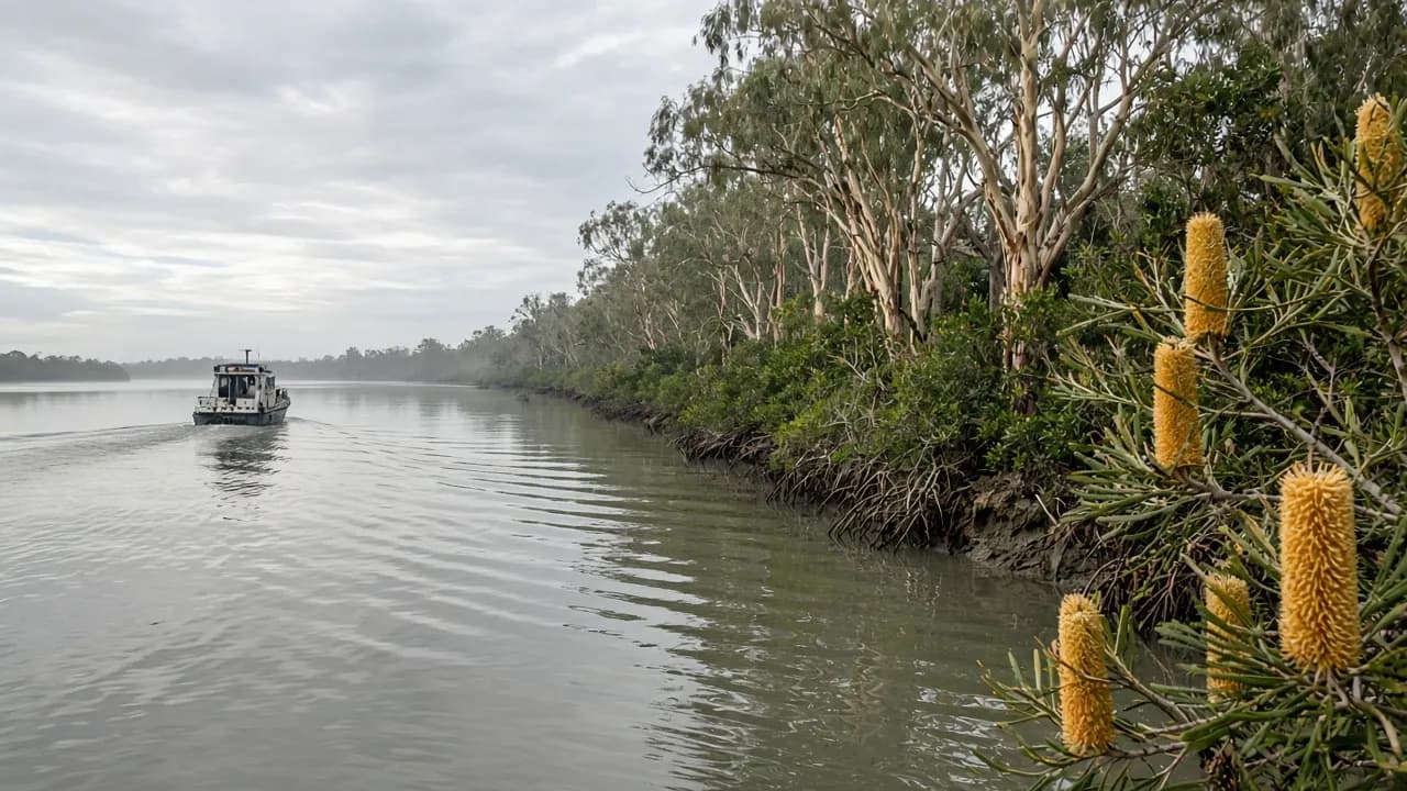
Most photographs sold as “Bribie” are either surf or a sunset over water that looks like a lake. The sunset water is usually Pumicestone Passage. It is the reason the bridge exists where it does, the reason Bongaree feels like a harbour suburb, and the reason a 4WD on the ocean beach is only half the island.
QPWS writes that fish, crabs and prawns breed here and that dugong feed on seagrass communities. Those sentences should slow a boat and sharpen a visitor. This guide is the long version of that slowing-down.
A working definition
Pumicestone Passage is the sheltered channel along Bribie Island’s west side, looking toward the Glass House Mountains coast. It is tidal, often shallow, edged with mangroves and paperbarks, and included in the broader Moreton Bay Marine Park protection of tidal wetlands and waters around the island. It is a working waterway: rec boats, fishing, and the daily bus and car traffic of people who live here.
It is not the ocean. It is not a theme-park lagoon. It is not a shortcut to Caloundra.
What you come here to do
Walk the township foreshores at Bongaree, Bellara and the parks further along the west. Watch wading birds on banks. Fish within the rules. Paddle or boat slowly, staying off seagrass. Photograph mountains over water when the air is kind. Eat nearby and go home without having needed a permit.
You can also use the passage as the recovery day after Ocean Beach: no cameras, no sand driving, no recreation-area entry, just the reminder that Bribie has a gentle face.
Boats and the heritage hire names
The old directory listed BBQ boat hire, other boat hire, and Ferryman-style cruises. Those slugs remain as historical mentions. If you want a boat, you need a current operator or your own craft, current safety gear, and a tide you have actually read. Shallow water punishes the confident.
QPWS asks visitors to go slowly over seagrass beds because dugong feed there. That is not a slogan for a brochure; it is the operational rule that should decide your throttle.
Kayaks and paddleboards belong to people who understand wind against tide. A westerly that looks pretty from a car park is a slog on the return.
Swimming in the passage
See the beaches hub. Passage swimming is a wade-and-judge activity. Channels cut through. Boats pass. Water quality and Lyngbya notices apply. It can be the right water for a child who does not need surf, and the wrong water on a bloom day.
Do not teach someone to swim here because it “looks safer” without looking at the day’s conditions.
Fishing the nursery
Read fishing. The ethical load is heavier on this coast than the marketing ever admitted. A nursery that is also a popular weekend fishery needs size limits and habitat care more than it needs another unpublished hotspot.
Stay off roosts. Take your line scraps. Do not treat a mangrove edge as a bin.
The northern passage and the park
Not every western shore is a township park. Poverty Creek and other named passage camping or day-use areas appear in official park material as places with shade, barbecues, and views to the Glass House Mountains — and as places you reach with park planning, not with a supermarket trolley. Confirm those sites on the QPWS pages. This guide will not drop a pin that might be closed.
White Patch is the mood change: streets, then the possibility of a recreation-area entry. If you came for a passage stroll, you may not need to pass that sign.
The 2022 cut, seen from the west
The coastal bar that opened about two kilometres from the northern end is an eastern, ocean-facing fact that split the park. It also changed how people talk about “going to the top of Bribie”. From the passage you may hear new water movement and new advice. You will not find a public drive-through to the Sunshine Coast. The breakaway has its own prohibitions: no dogs, no fires, no camping.
Mainland edge
Sandstone Point looks at the same water from the other side. The bridge is a viewing platform you are not allowed to treat as a footpath attraction in a traffic sense — it is a road. If you want to sit beside the passage, sit in a park, not on a shoulder.
A passage-only day from Brisbane
Train to Caboolture, bus over the bridge, walk Bongaree, eat, walk again, bus back. That day is complete. It does not require Woorim to be valid. It is the day this island can offer people who will never own a 4WD.
If you do add the east, add it as a second movement with time attached, not as a “while we’re here”.
Sources to keep open
- QPWS about Bribie Island
- Moreton Bay Marine Park information on the Queensland government domain
- Translink planner
The passage will still be here if you leave it kinder than the last BBQ-boat brochure implied.
Tides as the main character
If you only learn one passage skill, learn to look at a tide chart before you look at a café. Slack water can make the channel look like a lake photographed for a brochure. Run-out and run-in turn the same view into moving water with banks that appear and vanish. Waders who follow a sandbar can find a channel on the way back. Small boats that wander off a marked or known path can wait for the next tide in a more educational way than they wanted.
The Glass House Mountains do not care about your tide. They will still be in the picture if you wait an hour. The dugong and the seagrass do care about your prop.
Birds, banks and when to put the camera down
The passage and the northern banks are part of a Ramsar story. That word exists because migratory and resident shorebirds use these habitats at a scale that is not local trivia. Walking a roost to “get the shot” is the same as walking into someone’s only rest stop. Use a longer lens or a longer sit. If birds lift off because of you, you are too close.
Dogs belong in the conversation even on a township day. Leash rules and park bans exist for this reason, not because rangers dislike pets. The northern breakaway’s dog ban is written in plain official language. Respect it.
Villages along the water
Bongaree is the public living room. Bellara and Sylvan Beach are the residential continuation — useful if you are staying there, quieter if you are walking. Banksia Beach and Pacific Harbour add canals: private edges mixed with public roads. Do not assume every bulkhead is a fishing platform.
White Patch is the last township mood before management language changes. If your passage day is about ice-creams and a pram, you may never need to see that change. If your passage day is about reaching a named park day-use area on the western park shore, you are now in QPWS territory and you should have read the park page before the esplanade ended.
Weather that looks prettier than it is
A hard westerly photographs well and paddles badly. Summer storm cells build over the mainland ranges and cross the passage faster than a hire-boat plan. Winter can be gin-clear and sharp. None of this requires a local nickname. It requires looking up.
Lyngbya is not a rumour from somewhere else in the bay. QPWS names the late-spring-to-mid-autumn window and the irritation risk. If a notice is current, the passage is still beautiful from a bench.
A research hour that is not a tour
Sit on the Bongaree foreshore and count the jobs the water is doing: nursery, road-of-sorts for boats, swimming-when-judged, photographic foreground, sewer of bad decisions when people leave line and cans. Then read the QPWS about page and the marine-park overview. You will know more than a directory that once sold a BBQ boat as a personality.
The heritage cruise and hire slugs on this domain are footnotes to that hour, not the hour itself.
Fishing the edges without a secret
Land-based fishing along public foreshore is the passage activity that needs the least equipment and the most rule-checking. Size and bag limits live on official Queensland pages. Private canal walls are not a public right just because they hold water. Night fishing from a park bench is a different courtesy problem than night fishing in a 4WD lane on the ocean beach, but rubbish is still rubbish.
If you hire a boat, you have bought time on a nursery. That is a privilege. It is not a reason to chase every boil you see into a seagrass flat.
What the passage is not
It is not a swimming-pool substitute on a bloom day. It is not a back door to Caloundra. It is not a jet-ski paddock in front of a roost. It is not “safe water” as a personality trait. It is a tidal, protected, used-by-real-people channel that happens to be beautiful from the first township you hit after the bridge — which is why a weekend can be complete without ever seeing Woorim, and why that sentence is allowed to stand.